Park Mid-Section Western Loop
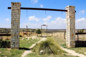
Burkett Park
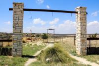
Burkett Park has a parking area, dry toilets, water for humans and horses and a covered picnic table with a few more picnic tables down the road. Good place to begin many hikes in the South Shore.
User: MikeHikes - 4/13/2014

Location: San Angelo State Park

Rating: 5stars
Difficulty: 2stars  Solitude: 4point5stars
Miles Hiked: 6.00 Miles  Elapsed Time: 2 hours, 30 minutes

Comments:

Out    Burkett Park > Burkett Trail > East Potts Creek > Armadillo Ridge > Playground > Old Road      3.2 miles
Return  Turkey Creek (South) > Armadillo Ridge > West Potts Creek > Rollercoaster Trail > Asphalt road to Burkett Park   2.8 Miles

This loop will take you through the park's mid-section and along the western edge of the park .  

Enter through the South Shore gatehouse and drive a couple of miles to Burkett Park which is the trailhead for the Burkett Trail.  You'll head North along a hard packed dirt trail with a few sections of loose, small rock.  Lots of red earth here!  Near the mid-point of this trail, you'll walk beneath Pulliam Point on the left - this is the furthest point on the South Shore you can drive to.  Rounding the point, the trail is narrow, climbs slightly and full of small rocks.  Be aware of bicyclist on the trail - it is somewhat narrow and you will have to give way.

Follow the trail and at a small junction, stay to the right, you'll cross a bridge over a dry creek.  Continue straight to the end and you'll see a signpost for Potts Creek across a dirt road - this trail is actually East Potts Creek Trail although some maps, and Google Earth, call it "Armadillo RidgeTrail".

East Potts Creek is mainly flat, hard packed dirt and meanders through mesquite groves.  Near the end of this trail you'll climb a bit and come to a signpost for "Armadillo".  Go to the right.

As you climb this trail, keep you eyes open when you reach the crest.  You'll see an abandoned picnic area and you need to look for a dirt path leading into the day use area.  Take the dirt path and follow it to a cattle water tank.  Near the tank, look for a straight dirt path that is a little to your right (about 45 degrees - North).  Follow it and you will connect to the Playground Trail.  Unfortunately, there is no signpost marking this trail but if you come to a road and look right, you'll see an abandoned pavillion shelter.  Cross the road and follow the trail.

About 50 meters or so you should see another trail on your right, joining this trail - continue to go straight.

Now, this is where having a laminated map of the trails (available for $3 at the South Shore gatehouse) comes in handy.  You will stay on the Playground Trail for quite awhile and it has switchbacks which may confuse you.  The trail is rocky and narrow in places as it takes you along the edges of some fingers of land.  Easy rule of thumb - the trail is very clearly defined and although there are a few loops in the trail, follow it generally ENE to Bell's Point, a local landmark where a marker, covered table and water is available.

When you leave Bell's Point you are still on Playground Trail for a short while.  Again, no signpost but just follow the easily seen trail, not the old road.  The trail will take you down into a valley and through mesquite groves until you come to a dirt road.  At this point, you'll see a signpost for Flintstone Trail - once again, Google Earth does NOT show this, it says Playground Trail continues when it actually ends at this point.

At the dirt road, turn left (West) and walk about a quarter mile until you see the Turkey Creek Trail sign on the left (South).  The first sign is for hikers and horses, I recommend you go a little further down the road until you see the trail designated for hikers and bikers.

Follow Turkey Creek until it "T"s into the Armadillo Ridge Trail. Turn right (West) and follow Armadillo RidgeTrail until it ends and you see the West Potts Creek trail signpost which immediately begins at this point.

West Potts Creek trail ends at an asphalt road and Rollercoaster Trail is directly across. 

Hike Rollercoaster all the way to the end and you come to an asphalt road.  Directly across the road is the signpost for Lanky Lackey trail, you will not take this but will turn left (North) on the road.  The road branches about 30 meters later, take the right hand branch (East) - this takes you to Burkett Park and the end of the hike.

NOTES -

(1)  Be advised the Playground Trail is probably the least well marked trail in the entire park.  There is only one signpost denoting this trail and it is where Flintstone ends and Playground begins.  When you are on Armadillo Ridge trail and crest the ridge, I strongly suggest you look for the cattle tanks at the abandoned day use area and follow the path rather than negotiate the entire Armadillo Ridge trail.  There are a few animal trails that could be mistaken for the designated trail.

(2)  At the time of this writing, some cactus were beginning to bloom - notably the horse crippler cactus.  

(3)  I suggest you drink plenty of water and fill your water containers at both Burkett Park and Bell's Point - stay hydrated!!


Log Photos
Burkett Park
Area around San Angelo State Park