South Shore Burkett Park to Cougar Outlook via Service Roads

Be advised the longhorns wander within some hiking areas of the park - they are NOT PETS and can be protective when calves are around. Respect them, leave them alone and they will leave you alone.
Log Photos
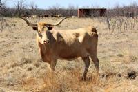
Longhorns Wander Through the Park's Hiking Areas
Area around San Angelo State Park