Park Mid Section Burkett Park to Cougar Outlook
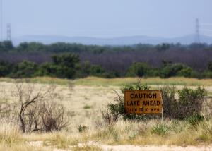
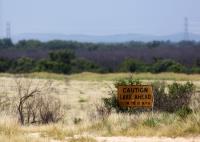
Don't Believe It !!
Although we've had some rain lately, this sign is from L-O-N-G ago. Maps show O.C. Fisher Reservoir as being a fairly large lake - it is currently at 1% capacity and all the water is at the southern end by the dam. UPDATE 09-16-20 Water level is 7.2%
User: MikeHikes - 8/20/2014

Location: San Angelo State Park

Rating: 5stars
Difficulty: 2stars  Solitude: 5stars
Miles Hiked: 7.00 Miles  Elapsed Time: 3 hours, 15 minutes

Comments:

Out      Burkett Park > Burkett Trail > East Potts Creek Trail > Armadillo Ridge Trail (West) > Turkey Creek Trail (North) > River Bend Trail > service road (East) > Cougar Outlook     4.3 miles

Return  Cougar Outlook > service road (WSW) > asphalt service road (South) > dirt service road (WSW) > Burkett Trail > Burkett Park    2.7 miles

Basically this route consist of going out on the trails and returning via the service roads.  I suggest using Google Earth to see the route as it is fairly easy to follow.

We've had a few days of much needed rain, which didn't do much except get the trails wet and full of sticky mud so I waited until the trails dried up a bit.  Warm temps were tempered by fairly consistent winds today as I hiked.

Not much to see in the way of wildlife unless you count the longhorns - I ran into two groups of them; we acknowledge each other's presence and left it at that.  

Saw one hiker at Burkett Park as I was leaving, otherwise I had the trails to myself for the entire hike.

NOTES

Water, shade, info kiosk and dry toilets available at Burkett Park.

Water, shade and info kiosk are available at the northern end of Turkey Creek Trail where it joins the River Bend and Flintstone Trails - this is about 3.2 miles outward bound on this hike.  I suggest you take the time to hydrate and refill all bottles because there is no other water available.

NO WATER, only shade and an info kiosk are available at Cougar Outlook.


Log Photos
Don't Believe It !!
Area around San Angelo State Park