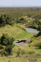
Park Mid-Section Burkett Park to Cougar Outlook
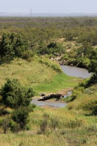
Low Water in the North Concho River
The rock you see is normally covered when the water flows in the river - easy to see what the drought has done to the area. We need rain and lots of it!
User: MikeHikes - 9/1/2014

Location: San Angelo State Park

Rating: 5stars
Difficulty: 2stars  Solitude: 3point5stars
Miles Hiked: 9.50 Miles  Elapsed Time: 4 hours, 20 minutes

Comments:

Out     Burkett Park > park road (West) > Roller Coaster > West Potts Creek> Turkey Creek> River Bend > service road (East) > Cougar Outlook      4.8 miles

Return  Cougar Outlook > Flintstone > Playground Trail > Armadillo > East Potts Creek > Burkett Trail > Burkett Park    4.7 miles

Windy and hot are the best ways to describe today's hike. Not many birds, reptiles or insects were visible today although there were at least a dozen mountain bikers I saw at various times on the trails. Some of the vanilla scented bee brush is in bloom and patches of thistle have started to bloom as well.  Not much of interest on this hike but regardless of what I see or don't see, every hike is worth the time and effort - I always look forward to the next one!

NOTES

Water, shade, info kiosk and dry toilets available at Burkett Park.

Water, shade and info kiosk available at the junction of Turkey Creek, River Bend and Flintstone trails (about 3.5 miles out).  If you follow my route exactly, you'll return to this point when you travel the Flintstone Trail from Cougar Outlook.

Shade and info kiosk available at Cougar Outlook  (4.8 miles out).

Water and shade available at Bell's Point - on the return leg as you're hiking on Playground Trail - about 1 mile from the multi trail junction.


Log Photos
Low Water in the North Concho River
Area around San Angelo State Park