North Shore Bell's Trailhead to 5 Points Junction
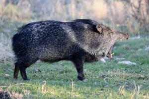
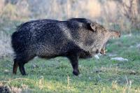
Big Yawn!
This javelina's photo was taken at the park's South Shore bird blind. I think, if irritated, this guy could get a good chomp out of anyone. Observe but don't annoy!
User: MikeHikes - 2/10/2015

Location: San Angelo State Park

Rating: 5stars
Difficulty: 1point5stars  Solitude: 4point5stars
Miles Hiked: 9.60 Miles  Elapsed Time: 4 hours, 10 minutes

Comments:

Out       Bell's Trailhead > service road (S) > Dinosaur Trail > Upper Big Hill > Badlands > River Bend > 5 Points Junction         5.2 miles

Return   5 Points Junction > Flintstone (NNE) > Javalina > Lower Ghost Camp Trail > South Slick Rock > service road (N) > Scenic Loop > service road (ENE) > Shady Trail > Bell's Trailhead       4.4 miles

Hike began with sunny skies, steady South wind and 60 degree temps but ended at 80+ degrees!  I wandered through the North Shore primarily to see what the park looked like after the prescribed burns of a month or so ago.  The biggest area burned is on Dinosaur Trail, which is mostly open, but there are areas scattered around that were burned as well. 

No wildlife observed, just birds.  Surprisingly, I picked up three bags of trash today.  Most of it was old stuff so I'll credit the burn with uncovering the old cans and glass.  I found a relatively new and functional, although slightly melted, flashing safety light.  I stowed it in my pack and will keep in just in case!

NOTES

Water, shade and info kiosk at Dinosaur Tracks area.

Water, shade and info kiosk at 5 Points Junction - BE ADVISED this is the last place you will have the opportunity to get water if you follow my route.  HYDRATE WHILE YOU CAN!

Shade and info kiosk at Cougar Outlook (junction of Flintstone and Javalina trails on return leg).

Dry toilets, shade, info kiosk and water FOR HORSES ONLY at the Upper Ghost Camp (junction of Lower Ghost Camp and South Slick Rock trails on return leg).


Log Photos
Big Yawn!
Area around San Angelo State Park