Burkett Park to Bell's Trailhead
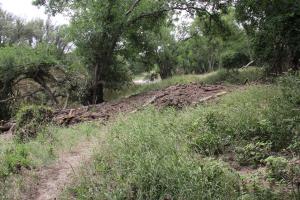
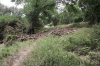
Shady Trail Flood  Debris
When the North Concho River flooded, there was a lot of debris left behind in the park that will take some time to remove. This mound is on the Shady Trail (North Shore).
User: MikeHikes - 5/28/2015

Location: San Angelo State Park

Rating: 4point5stars
Difficulty: 1star  Solitude: 5stars
Miles Hiked: 19.30 Miles  Elapsed Time: 7 hours, 30 minutes

Comments:

Out     Burkett Park > Burkett Trail > East Potts Creek > Armadillo > Playground > Flintstone > Javalina > Lower Ghost Camp > South Slick Rock > service road (N) > Scenic Loop > service road (ENE) > Shady Trail > Bell's Trailhead    8.8 miles

Return  Bell's Trailhead > service road (S) > Dinosaur Trail > Upper Big Hill > Badlands > River Bend > Turkey Creek > Armadillo (W) > West Potts Creek > Roller Coaster > Suzanne's Trail > Burkett Park  10.5 miles

Low 80's, light wind increasing in intensity as the hike progressed, partly cloudy sky with periods of bright sun.

This is the first time I've had a chance to walk the northern trails since the big rain storms of a few weeks ago which flooded the northern section of the park and brought the OC Fisher lake from less than 1% to almost 14% full.

To put it briefly - all the northern trails have flood damage including flood debris blocking the trail, embankments near the trail being washed away (which I believe will cause the trail to be re-routed for safety reasons), damage from the Longhorns using the muddy trails and making them very difficult to traverse, overgrown vegetation masking the trails and making snake avoidance difficult and finally, the ever present stagnant mud and MOSQUITOES.

This is not to say the trails in the park's trails in the mid-section and southern portions were pristine; they are not, but the storm's effects are negligible in comparison with the exception of the overgrown vegetation and numerous mosquitoes.

The mosquitoes were incessant - at one point while on Roller Coaster, the buzzing I heard was so loud,  I thought I was walking past a beehive, but I quickly realized mosquitoes were making the noise.  I didn't bring bug repellent so I was constantly swatting and killing mosquitoes in all the low lying areas I traversed yet I still counted 30 bites the following morning.

As the day progressed, the winds picked up so when I was in areas that were higher up and in the open, the mosquitoes weren't as bad but when I had to go into the dips and valleys - it was a constant battle!!

The positives of the recent rains far outweigh the negatives and I will be prepared for future hikes by bringing lots of repellent!

NOTES

Water, shade, info kiosk and dry toilets available at Burkett Park.

Water amd shade available at Bell's Point (near the northern end of Playground Trail).

Water, shade, amd info kiosk available at 5 Points Junction (River Bend, Turkey Creek and Flintstone intersection).  If you follow my route you will visit this on both legs of the trip.  I STRONGLY advise you to hydrate as much as possible when visiting - there is one water area in the northern portion of the park and if you follow my return route, this is the last water area as you hike back to Burkett Park.

Shade and info kiosk available at Cougar Overlook (junction of northern end of Flintstone and Jvaalina trails).

Shade, info kiosk and dry toilets available at River Bend Campground (ghost camp) near the northern end of the Lower Ghost Camp Trail.  Water is also available for ANIMALS only.

Water, shade and info kiosk available at the Dinosaur tracks area along Dinosaur Trail (about 1.5 miles South from Bell's Trailhead).  This is the ONLY water area in the northern portion of the park.


Log Photos
Shady Trail Flood Debris
Area around San Angelo State Park