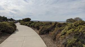
Coppertone and Imade a repeat visit to the Napa-Sonoma Mashes Wildlife Area to map out some additional trail segments. This time it was the Wetlands Edge Linear Path that adjoins the main parking lot at the corner of Eucalyptus Drive and the aptly named Wetlands Edge Road.
Yes, at first glance this is just a sidewalk trail. Look to one side of the trail and you'll see nothing but a street and single family homes. But look in the other direction and you'll find the qualifications for a "hike", of sorts anyway.
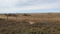
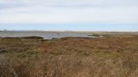
To the west of the path lies most of the Napa-Sonoma Marshes Wildlife area within view. The mostly treeless expanse provides ample vistas miles off into the distance. Views as far away as Mount Tam in Marin County are readily apparent. Depending upon your luck, you might also spot flocks of shorebirds in the marshes either taking a rest or foraging for food.
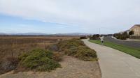
We continued on the path until it ended up under the high voltage power lines cut through the neighborhood and cross the marshes. Though a path continues along the power line path that seems likely a different trail and we were not sure how long it continues. According to the park map at the trailhead their trail ends near the Turnaround marker in our map.