Coppertone and I hiked a small section of the Rollye Wiskerson Trail earlier when we ascended the Vallejo-Benicia Buffer Trail. We made a note to return in order to map out that trail, which was our plan for the day.
We started our hike at the trailhead located in the Benicia Community Park. There's lots of parking around the perimeter of the ballfields. A paved walking path leads to the back of the park where the trailhead resides.
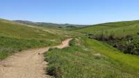
The trail starts off climbing a small, but quite steep, hill. At the top of this hill we found a family looking around anxiously for something. We correctly deduced they were geocaching and were new to the pasttime. We stopped for a moment and gave them a few pointers, which seemed to help and they found the cache soon thereafter. We logged the find as well and then started our hike in earnest.
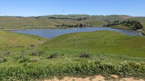
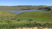
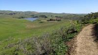
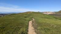
As the trail leaves the park it starts to hug a ridge separating houses from the watershed leading into Lake Herman. Along the way the trail will pass by a couple of small neighborhood parks, Gateway Park and Channing Circle Park.
The Rolly Wiskerson Trail proper follows the contours of the neighborhood boundary and ends at Channing Circle Park. But at a junction prior to that we opted to ascend the very steep connecting trail that joins up with the Vallejo-Benicia Buffer Trail near where we turned back a couple of weeks ago.
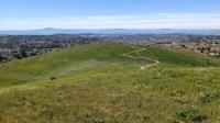
It was a windy day. A couple of paragliders were prepping to take off from the grass covered slopes. They had not worked out their logistics before we continued on down the trail.
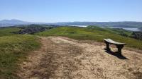
We decided to continue well past our previous turnaround point near the summit at Doris Klein's Bench and follow the trail all of the way to its conclusion at Ascot Parkway.
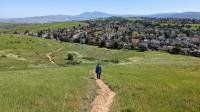
There is parking along Ascot Parkway, so it could be used as an alternate trailhead. We doubled back towards our car, counting up 7.22 miles in the process.