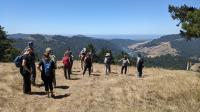
Group hike to West Pole overlooking the Russian River and Pacific Ocean
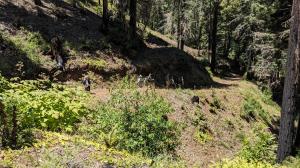
Descent
We retraced our path back to the trailhead. The descent made conversation amongst the hikers a little easier.
User: Austin Explorer - 7/11/2026

Location: Monte Rio Redwoods Regional Park

Rating: 4stars
Difficulty: 3point5stars  Solitude: 3stars
Miles Hiked: 6.77 Miles  Elapsed Time: 4 hours, 20 minutes

Comments:

Sonoma County Regional Parks hosted a guided hike to Monte Rio Redwoods Regional Park that we thought would be a good introduction to a place we had not hiked before.  In all, about 20 participants attended the planned 6.5 mile hike to the West Pole overlook.

Parking can be a bit tricky at Monte Rio, particularly when a group of 20 show up at the same time.  We were lucky to snag the last spot in the small parking lot.  There were plenty of other spaces along the road however.

Monte Rio Redwoods now consists of 2,030 acres, stictched together over time.  The acreage mostly came from former timber operations that have logged the general area as recently as 2022.  This new park's master plan is still under development but operates under provisional rules that allows for hiking and biking activities.

The trails are well maintained and mostly shaded.  There are plenty of Redwoods, oaks and Bay Laurel trees providing ample shade.  Our route featured several steep sections gave a few of us pause to catch our breaths.  A low water crossing in a steep canyon with lots of steps was fine on the first traverse, but was a bit of a knee wobbling challenge on the return leg.

Our goal was to have lunch at the West Pole lookout on the western edge of the park.  The view from this spot was spectacular.  Looking down into the Russian River valley one can see the meandering of the river as curves around the last few remaining ridgelines before emptying into the vast Pacific Ocean.

After finishing our lunch we by chance encountered Sonoma Regional Parks Director Bert Whitaker.  He just so happened to be mountain biking on the trails on his free time.  He paused his ride to chat with us and filled in some more details about the arduous process of land acquisition and partnerships that were required to create the regional park we were enjoying today.

Our group doubled back exactly the way we had ascended.  The easier descent led to a few more conversations amongst the hikers.  There was an interesting mix of folks with different stories about their interests and what drew them to today's outing.

After almost 4 and a half hours of hiking we covered 6.77 miles, close to the advertised 6.5.  Elevation gain was only 1,056 feet, lower than the expected 1,500 feet.


Log Photos
Chatting and regrouping at West Pole
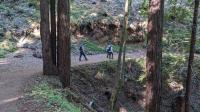
Trail View
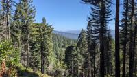
Vista peeks
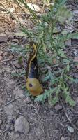
Banana Slug
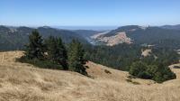
West Pole View
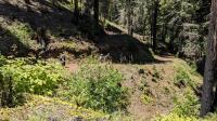
Descent
Track File
Loading...
Map LogoLarger Map   Download Download