San Angelo State Park Photos
Return to San Angelo State Park
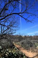
Although it may look like a meteor, it wasn't. The upper atmosphere was still and I watched as a jet left a contrail from one edge of the horizon to the other. (Photo by
MikeHikes)
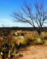
This was taken near Cougar Outlook in the middle of the park. (Photo by
MikeHikes)
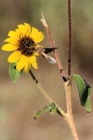
Was surprised to see this sunflower still in bloom and a moth sipping the nectar. (Photo by
MikeHikes)
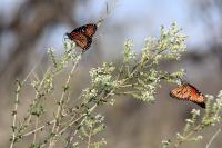
A few bee brush plants are blooming once again and the butterflies are enjoying them. I enjoy the vanilla scented blooms as well! (Photo by
MikeHikes)
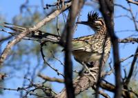
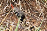
Came upon this road runner as he was hunting a tree lizard on the Lanky Lackey trail. The road runner went into the tree and the lizard was saved. (Photo by
MikeHikes)
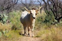
About 25-30 members of the Longhorn herd decided to rest on a portion of the Flintstone Trail. When I approached, they watched for awhile before eventually getting up and walking the trail in front of me, all the while depositing lots of fresh dung. (Photo by
MikeHikes)
A nice picture taken awhile back while staying at the park. (Photo by
MikeHikes)
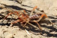
First time I've seen one of these! I saw this one on the Turkey Creek Trail as I was heading back. Probably about two inches long - Note the ant caught on his leg (which were covered in hairs) (Photo by
MikeHikes)
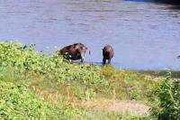
I'm aware of the feral hog problem in Texas but this is the first time I've seen feral hogs at the park. Photo taken at Cougar Overlook at 1:15 10/8/14. (Photo by
MikeHikes)
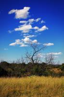
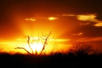
I take my camera whenever I hike so when I spotted this tree and clouds, I had to take the shot - it just looked nice! (Photo by
MikeHikes)
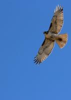
Best guess is a juvenile Broad-winged hawk. He was very leisurely flying overhead and at one point, he got into a small raptor's territory and the smaller bird chased him off! (Photo by
MikeHikes)
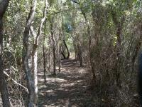
Shady trail located on the north side of the park has this interesting tunnel effect in a small grove of trees. (Photo by
rodavenport)
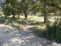
One of the prettier trails in the park. Make sure and catch it on the way by (Photo by
rodavenport)
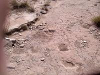
One of the better defined fossilized tracks. They are not nearly as clear and defined as the tracks at Dinosaur Valley SP. (Photo by
rodavenport)
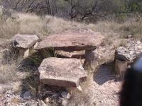
Flintstone Village on the Flintstone Trail (Photo by
rodavenport)
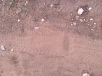
Somebody hiking in toed shoes makes for interesting footprints (Photo by
rodavenport)
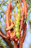
Not everyone around here likes the mesquite tree but I do. The trees provide shade for me and food for all kinds of animals. (Photo by
MikeHikes)
Don't know what kind of snake except he is not a rattler. Saw him stretched on the trail and was able to get a few pics of him tasting the air. He went his way, and we went ours. (Photo by
MikeHikes)
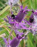
More and more of the purple thistle are showing up - means Fall isn't far behind and we'll soon see migrating birds. (Photo by
MikeHikes)
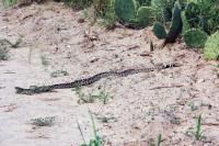
This guy was 5-6 feet long! He did not mind me taking his picture. I left him and when I returned a few hours later, he was gone. (Photo by
MikeHikes)
 BackNext