Hood Mountain Regional Park Photos
Return to Hood Mountain Regional Park
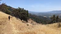
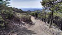
Coppertone leads the way back down the mountain to the trailhead. Sonoma Valley of off to our right. (Photo by
Austin Explorer)
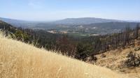
Looking for northwest from the picnic spot now we're afforded views of Santa Rosa. Note some of the extensive fire damage in the nearby hills. (Photo by
Austin Explorer)
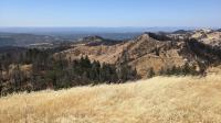
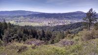
From the highpoint picnic area the view of Sonoma is more expansive, this time including its southern end. (Photo by
Austin Explorer)
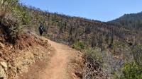
Lawson Trail skirts the edges of the park that remain closed due to the Glass Fire. To the right you can see some of the damage. (Photo by
Austin Explorer)
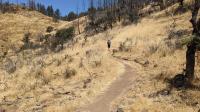
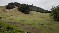
Tree cover on Lawson Trail is less prevalent and even in July the grass was parched and brown. (Photo by
Austin Explorer)
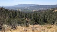
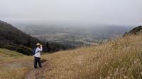
Rim View Point is not that high up Lawson Trail but it already provides a nice view into Sonoma Valley. (Photo by
Austin Explorer)
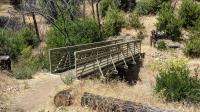
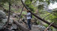
The new Lawson Trail is well designed and has great features like this new steel bridge. It even had a rubber walking surface. (Photo by
Austin Explorer)
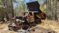
Fire damage in the area was not limited to trees and grass. Some homes in the area and this truck were consumed by flames in the Glass Fire. (Photo by
Austin Explorer)
Coppertone looks happy to almost done with the hike and thankful for the handhold over the log bridge. (Photo by
Austin Explorer)
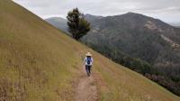
The path towards Sugarloaf sometimes slices through steep grassy fields, but traversing it thankfully. (Photo by
Austin Explorer)
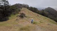
The winds were howling through this saddle ridge. (Photo by
Austin Explorer)
After moving on from the overlook the fog finally starts to burn off. It would get progressively clearer throughout the remainder of the hike. (Photo by
Austin Explorer)
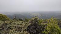
Where's our vista over Sonoma Valley? Mostly hidden by fog. (Photo by
Austin Explorer)
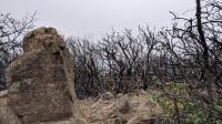
The very peak of Hood Mountain was badly burned, as these Manzanita bushes indicate. Some of them are already growing back though. (Photo by
Austin Explorer)
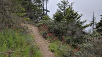
The hiker only Summit Trail was a pleasant change of pace from the main jeep trail and higher up it was not overgrown. (Photo by
Austin Explorer)
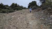
As we get nearer the summit the terrain turns rockier. (Photo by
Austin Explorer)
As we gain altitude we have more vista opportunities, but the fog is lasting longer than we expected. (Photo by
Austin Explorer)
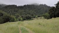
A family of hikers follow us down the path towards Santa Rosa Creek. (Photo by
Austin Explorer)
At the start of the hike the fog at elevation provided welcome relief from Sun and heat. (Photo by
Austin Explorer)
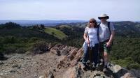
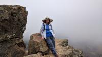
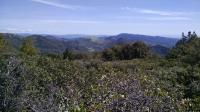
Coppertone and me at the overlook on the Panorama Ranch Trail overlooking the Azalea Creek Canyon. (Photo by
Austin Explorer)
The soil on the Panorama Ranch Trail is less nutrient rich, causing the trees growing here to be shorter then elsewhere in the park. (Photo by
Austin Explorer)
The view from the top of Hood Mountain. Thick tree and brush cover makes finding a vista point difficult. (Photo by
Austin Explorer)
A little farther down the path from the Valley View Trail vista point, there's more to be seen. (Photo by
Austin Explorer)
Next 