Newell Open Space Preserve Photos
Return to Newell Open Space Preserve
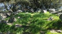
The SE corner of the preserve has trails (well, sort of) that are very much overgrown. Avoid the area for now, or wear long pants! (Photo by
Austin Explorer)
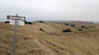
Metal signs are replacing wooden ones in the park. Let prone to weathering over time and of course some signs burned in recent fires. (Photo by
Austin Explorer)
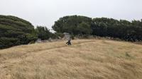
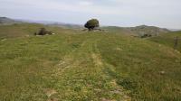
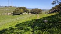
There's often a swift breeze blowing through this section of the park. The trees along the ridge here are swept into the direction of the wind as a result. (Photo by
Austin Explorer)
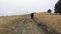
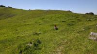
A cow stands motionless on the trail until we pass by. Then she commences heading downhill. (Photo by
Austin Explorer)
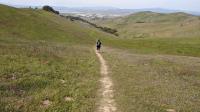
Coppertone leading the way along the Prairie Ridge Trail. (Photo by
Austin Explorer)
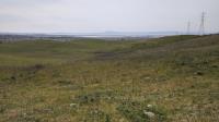
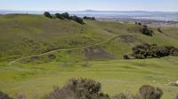
Looking down on American Canyon from the Prairie Ridge Trail. (Photo by
Austin Explorer)
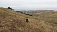
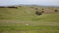
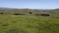
Looking back on the Prairie Ridge Trail at the brown, rolling hills. (Photo by
Austin Explorer)
Coppertone descends from the Prairie Ridge Trail. American Canyon and the Napa-Sonoma Marshes Wildlife Area can be seen in the distance. (Photo by
Austin Explorer)
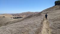
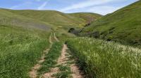
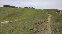
Prairie Ridge Trail is a segment of our favorite route through some of the best parts of Newell. (Photo by
Austin Explorer)
We'd seen plenty of Lupine along the trail leading into this valley in year's past. But there was no sign of them this year. (Photo by
Austin Explorer)
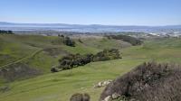
The short Overlook Trail leads to this vantage point over American Canyon. Mount Tam is in the center of the picture in the distance. (Photo by
Austin Explorer)
Coppertone descends along the Southeastern Trail that connects the Loop Trail with the Prairie Ridge Trail. American Canyon is in the distance. (Photo by
Austin Explorer)
Looking into Lynch Canyon Open Space Preserve from the Prairie Ridge Trail. (Photo by
Austin Explorer)
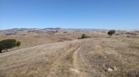
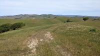
The Prairie Ridge Trail snakes forward and then to the left, just to the left of the sparse, wind swept, tree line. (Photo by
Austin Explorer)
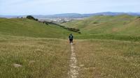
After some climbing from the valley below we topped out onto Prairie Ridge and looked back from where we'd come. (Photo by
Austin Explorer)
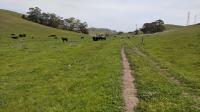
A good number of cows seemed to enjoy lounging around the Saddle Trail. (Photo by
Austin Explorer)
The shape of the trees that exist on the edge of the ridge give testimony to the frequent and strong winds that occur here. (Photo by
Austin Explorer)
Most of the Prairie Ridge Trail is open to the skies. Here the trail darts through a small copse of trees, providing some relief from the Sun's rays. (Photo by
Austin Explorer)
The Prairie Ridge Trail is also part of the Bay Area Ridge Trail, marked by the short orange posts. (Photo by
Austin Explorer)
The Loop Trail forms a V a couple hundred feet below. Mount Tam can be spotted in the distance. (Photo by
Austin Explorer)
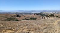
A great view of the City of American Canyon and the Napa River marshes from the Prairie Ridge Trail. (Photo by
Austin Explorer)
Many views from the Prairie Ridge are spectacular. Here's the view NE into Cordelia and beyond. (Photo by
Austin Explorer)
Next 