The Forest of Nisene Marks State Park Photos
Return to The Forest of Nisene Marks State Park
There are plenty of large Redwoods here and they're getting bigger. Coppertone looks skyward for a glimpse. (Photo by
Austin Explorer)
Coppertone on the upper reaches of Loma Prieta Grade. We found some of the largest stumps here, evidence of logging years ago. (Photo by
Austin Explorer)
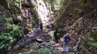
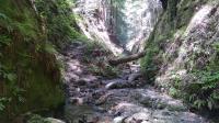
Coppertone and a couple of other visitors navigate a narrow, but clear path through the canyon. (Photo by
Austin Explorer)
Coppertone stops for a moment on the way out of the canyon showing the tangled mess of rocks and trees that had to be navigated. (Photo by
Austin Explorer)
A higher view of Maple Falls showing its upper reaches. (Photo by
Austin Explorer)
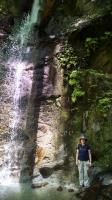
Coppertone poses at the base of Maple Falls. By this time a surprising number of people had joined us. (Photo by
Austin Explorer)
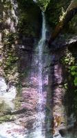
We finally reach our goal, the real Maple Falls. (Photo by
Austin Explorer)
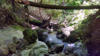
The trail leading to Maples Falls gets rougher with numerous creek crossings. (Photo by
Austin Explorer)
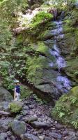
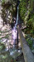
At first we were not sure if this was Maples Falls or not. It's not. We had to keep going upstream. (Photo by
Austin Explorer)
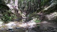
Bridge Creek Trail as it parallels and crosses its namesake. (Photo by
Austin Explorer)
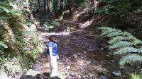
Coppertone looks enthusiastic about this creek crossing. (Photo by
Austin Explorer)
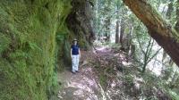
Coppertone stops for a moment on the trail. Note the lichens growing on the steep rock to the left. (Photo by
Austin Explorer)
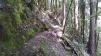
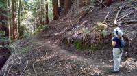
The trails sometimes hug steep hillsides peppered with Redwoods. (Photo by
Austin Explorer)
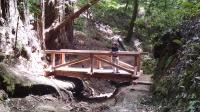
Coppertone admires the fine handiwork on one of the very new bridges built at a couple of creek crossings. This one actually had a tiny bit of work remaining to be done. (Photo by
Austin Explorer)
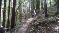
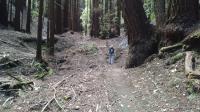
The hiking only trails are more narrow and more quiet. (Photo by
Austin Explorer)
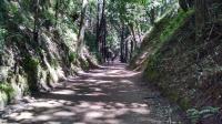
The main multi-purpose trail through the park is marked unpaved, but at times is almost as smooth as if it were paved. (Photo by
Austin Explorer)