Napa-Sonoma Marshes Wildlife Area Photos
Return to Napa-Sonoma Marshes Wildlife Area
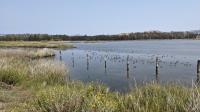
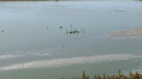
Scores of small wading birds were foraging for food not far off the Glass Beach Trail. (Photo by
Austin Explorer)
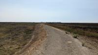
Looking east from the trail towards American Canyon. Newell Open Space Preserve lies in the hills beyond. (Photo by
Austin Explorer)
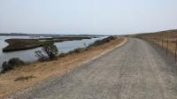
The landfill is fenced off from the trail here and marshes which surround it are on the right. (Photo by
Austin Explorer)
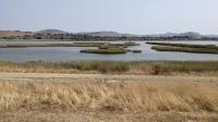
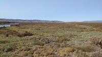
The marshes that give the wildlife area its name. The capped landfill that we'll hike around can be seen on the right. (Photo by
Austin Explorer)
We finally saw a small number of wading birds in one of the two effluent ponds along the trails. (Photo by
Austin Explorer)
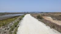
The trail surface after crossing the bridge is courser gravel, which is not as easy to walk on. But it's not too bad. (Photo by
Austin Explorer)
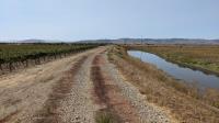
On the edge of the wildlife area there a vineyard, because... Sonoma County! (Photo by
Austin Explorer)
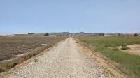
No trees means you can see for miles. Looking towards the northwest towards Sonoma Mountain. The metal barn structure near the park trailhead can be seen to the right. (Photo by
Austin Explorer)
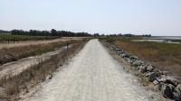
Here the trail is a wide gravel path on a raised berm. (Photo by
Austin Explorer)
The short quarter mile trail to the Ringstrom Unit ends once the ground becomes overgrown and marshy leading up to the water. (Photo by
Austin Explorer)
The trail is in Napa County, so of course there's a vineyard along the way. ground squirrels also love the area. (Photo by
Austin Explorer)
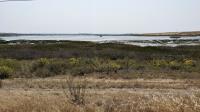
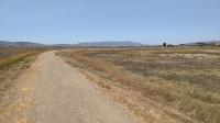
Much of our hike was along a berm that separated marshland on the left from the dryer land on the right. With no trees, the views extend for miles. (Photo by
Austin Explorer)
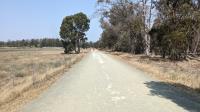
This trail segment near our trailhead is part of the San Francisco Bay Trail. There is some tree cover here, for now. (Photo by
Austin Explorer)
 Back
Back