Hike, Bike, Ride Horses, Fish Or Canoe At Spring Creek
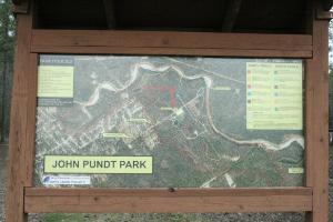
Park Layout And Trail Map
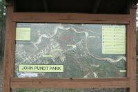
This display shows the park layout and the various trails running through it.
User: Blaze - 2/18/2013

Location: Pundt Park

Rating: 1point5stars
Difficulty: 1star  Solitude: 2point5stars
Miles Hiked: 2.20 Miles  Elapsed Time: 1 hour

Comments:

Pundt Park is a park designed for hikers, bikers, equestrians and people that like to canoe.  It sits along a sandy part of Spring Creek, making it a good canoe launching spot.  There are also numerous dirt trails that go through the woods that you can hike or bike, but the trails are all fairly short.  They are:

  • Fallen Pine Trail
  • Heron Trail
  • Creekside Trail
  • Walnut Trail
  • Oxbow Trail
  • Red Bay Trail
  • Bay Grove Trail
  • Hardwood Trail
  • Hart Pundt Lake Trail

The Creekside Trail is sandy (like beach sand) and a bit difficult to walk on, but it affords you some nice views of Spring Creek.  The Oxbow Trail does, too, but the trail becomes difficult to follow in the vicinity of Spring Creek.  If you can get through, it leads you to a small pond with benches to relax on.

The signage in Pundt Park is very good.  At the intersection of every trail, there are signs telling you the names of the trails.

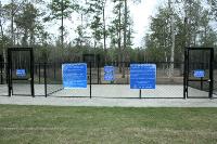
Pundt Park also has a small dog park contained within it called Bibi & Mini-Me Bush Dog Park that is gated so dogs can run around freely.  Outside the dog park, dogs are required to be kept on leash.

There is also a nice playground and picnic area for kids and family.

In my opinion, one of the nicest things about Pundt Park is it gives you access to the Spring Creek Greenway Trail which takes you along Spring Creek to the Stahl Preserve (about 2 miles to the east) and eventually out to the Jesse H. Jones Park & Nature Center (about 8 miles to the east).

I visited Pundt Park coming via the Spring Creek Greenway Trail.  I departed from and returned to the Jesse H. Jones Park & Nature Center.  It's about 8 miles between Pundt Park and the Jesse H. Jones Park & Natyre Center, making it a 16 mile round-trip.  You can read my log of the Spring Creek Greenway Trail here.


Log Photos
Park Layout And Trail Map
Dog Park
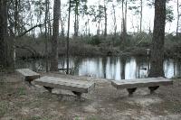
Small Pond At The End Of The Oxbow Trail
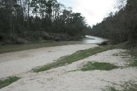
Canoe Launch
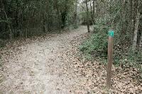
Creekside Trail
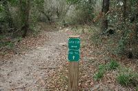
Oxbow Trail
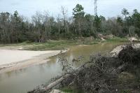
Spring Creek
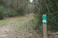
Some Trails Intersect With The Spring Creek Greenway Trail
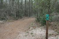
Excellent Signage
Area around Pundt Park
BESbswy