Get Lost!

Entrance Sign
This is the sign to the entrance of the park off Hufsmith Road.
User: Blaze - 2/24/2013

Location: Burroughs Park

Rating: 1star
Difficulty: 1star  Solitude: 3stars
Miles Hiked: 7.50 Miles  Elapsed Time: 2 hours, 30 minutes

Comments:

OK, if you've read my logs, you know that poor signage is a pet peeve of mine.  It makes no sense to me why you would go through all the time, effort and money to create trails for the public to enjoy and then fail to put proper signage in place.  My sense is that the people that make the trails know where they go so they don't see the need to put direction signs in place.

Also, just a point of clarification.  Loner556's log mentions Cypress Creek, but it is actually Spring Creek.

Now that I've got that off my chest, let me start my review.  Burroughs Park is a fairly large park in the country woods of Tomball.  The common areas of the park are really nice and include sporting fields, picnic areas, a dog park, a large scenic lake for fishing and a long, paved jogging trail that goes around the park.  I rate this part of the park very high.  It is a nice place to spend the day with family and friends.

The problem I have with Burroughs Park is with the trails area.  In fact, I have several problems.

First, the Harris County Precinct 4 website boasts "over 8 miles in nature trails", but this is way off, even if you include the paved jogging trail.  The reality is the hiking trail is less than half that distance.  This brings me to the next point.

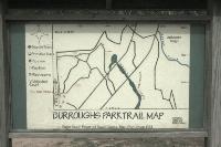
Second, at the trailhead, you are presented with not one display map of the trail system, but three.  That sounds wonderful, but it really adds a lot of confusion.  This should have been my first warning sign.

There are basically three documented trails - a short loop known as the Coon Trail (0.63 miles), another slightly larger loop known as the Hog Trail (1.4 miles), and finally the Deer Trail which is a walk around the trail park that includes the Coon and Hog trail loops as well as another unnamed loop near Spring Creek (for a total distance of 3.23 miles).  If you look at the park map, the Coon Trail is the small loop that starts near the parking lot, the Hog trail is the middle loop in the center of the wooded area, and the Deer Trail is basically a perimeter hike out to Spring Creek and back.

Sounds simple, right?  Well, the problem is there are a lot of unmarked/undocumented trails and utility service roads that criss cross throughout the park.  If you miss one trail marker and you don't have a GPS, you'll soon find yourself walking around aimlessly.

I know some of you are thinking that all you need to do, then, is pay attention and follow the trail markers.  True, but the problem is that some direction signs use the name of the trail (Coon, Hog, and Deer) and other signs use a color band system.  If you didn't memorize the trail color code system before you departed, oh well!  Furthermore, many of the direction markers were damaged or fallen over.  I'm not sure if storms knocked them down or if someone decided to pull a prank, but a lot of the signs were not planted.

Third, and last, there are a number of signs prominently sprinkled throughout the trail intersections that do not tell you which way to go, but point you back to the Parking Area.  So, instead of signs telling me where to go, I kept running into signs telling me where I did not want to go.  The chi energy was all wrong in this park.  Instead of the park inviting you to explore it's beauty and wonder, it was as if these signs were saying "Go Back To The Parking Lot", "Leave", "You're Not Wanted Here", "Get Out!".

So, in summary, the trails take you back through a nice, wooded area and through some lowland areas, but I couldn't enjoy it because I was constantly looking for indicators as to where I was.  I actually hiked the park TWICE, but not by choice.  The first time, I got lost and walked around for an hour and a half.  The only thing preventing me from truly getting lost was the barbed wire park boundary fence and tens of "<-- Parking Area" signs.  When I got back to the trailhead, I looked at the three maps again more carefully and decided to try again.  I got much further this second time, sometimes as a result of making some lucky guesses when I ran into forks in the trail that were not marked, but eventually I got lost again.  I soon realized that I had hiked all the way back into the park (where Spring Creek is) the first time.  At this point, I was pretty disgusted with the whole situation.  It was spoiling my day, so I decided to just "let it go" and just walk wherever my heart pleased.  The park isn't that large and it is contained by the boundary fence, so you really can't stray off the reservation.  The length of my hike was determined by hiking continuously for 3 hours.

I know some of the earlier reviews claimed the trails were well-marked, but I did not find that to be the case.  Perhaps it is because that was at least 4 or more years ago.  I also did not see any wildlife like AnOceanSpirit described.

This park has some true potential, but the parks and recreation folks need to improve the signage and trail markers.  This is low hanging fruit that shouldn't cost much at all.


Log Photos
Entrance Sign
Trail Map #1
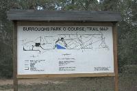
Trail Map #2
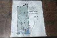
Trail Map #3
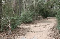
Trailhead
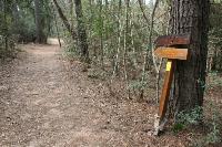
Direction Sign
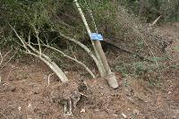
Another Uprooted Sign
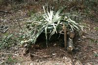
Trap
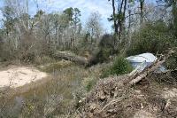
Spring Creek
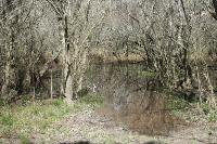
Wetlands