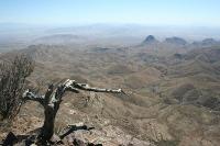
A Wonderful Hike With Breathtaking Views!
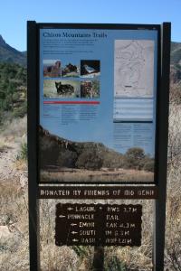
Trail Map
There are many routes up the Chisos Mointains. This display map at the trailhead shows the various trails you can take.
User: Blaze - 3/9/2008

Location: Big Bend - South Rim

Rating: 5stars
Difficulty: 5stars  Solitude: 3stars
Miles Hiked: 14.00 Miles  Elapsed Time: 8 hours

Comments:

This trail departs near the Chisos Mountains Lodge.  I went up the Laguna Meadows Trail, which was pretty much up all the way.  There were some nice spots, but the scenery is much better on the other trails.  From the Laguna Meadows Trail, I took the Southwest Rim trail which was absolutely fantastic, especially at the South Rim.  I then hiked along the Southeast Rim trail, but I could not go all the way around since part of the trail is closed from Feb 1 - Jul 15 due to the Peregrine Falcon breeding season.

So I circled back to the Boot Canyon Trail and then along the Northeast Rim.  The views here are spectacular also!

I then took the Boot Canyon Trail to the Pinnacles Trail back to the Lodge.  Along the way, I climbed Emory Peak and then came back down.  The way back to the Lodge was almost all downhill, which was helpful because I was pretty exhausted from ascending for many hours earlier in the day.

This is not an easy hike, but it is very beautiful.  You can do it in one day, but it will take you all day.  If you can camp overnight, it'll be much easier and enjoyable.


Log Photos
Trail Map
South Rim
Peregrine Falcon Breeding Season

Beautiful Vistas
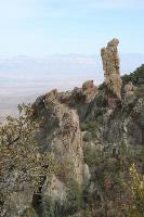
Interesting Rock Formations
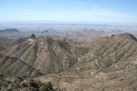
Simply Awesome
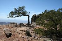
Another View Of The South Rim
Area around Big Bend - South Rim