George Bush Park Photos
Return to George Bush Park
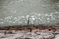
You'll often see blue and white herons and egrets along the water near the Buffalo Bayou Dam. (Photo by
Blaze)
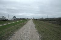
This shot of the seemingly neverending trail was taken on the north side of the Barker Dam. You can hike the gravel service road (shown here) or the paved hike/bike path below (off to the left). (Photo by
Blaze)
This shot was taken on the northeast side of the dam as it bends south. (Photo by
Blaze)
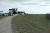
This is a view of the dam taken from the top of the bank along Barker Reservoir. The trail under the bridge in the distance will take you to Terry Hershey Park. (Photo by
Blaze)
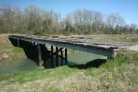
You won't see this old wooden bridge along the trail. It is located on the flood control channel close to and just west of the newer bridge (T-103). (Photo by
Blaze)
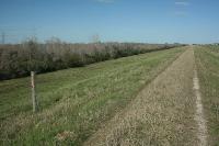
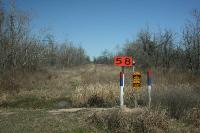
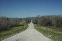
This gravel trail goes along the dam bordering the Barker Reservoir. There are distance markers every 1/4 mile. (Photo by
Blaze)
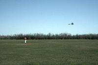
This Houstonian is enjoying the day flying his radio controlled helicopter at the Dick Scobee Model Airplane Fields. (Photo by
Blaze)
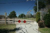
This is the end of the hike/bike trail at S. Fry Road. (Photo by
Blaze)
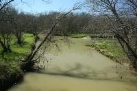
A view of an egret in the flood control channel that people like to walk along. (Photo by
Blaze)
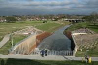
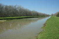
A view of the Buffalo Bayou and the adjoining Flood Control Channel that branches off to the right. (Photo by
Blaze)
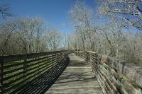
This is a view of the long, beautiful, wooden bridge that spans Buffalo Bayou along the George Bush Hike/Bike Trail. (Photo by
Blaze)
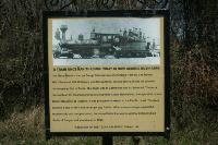
This sign explains a train used to run through the Barker Reservoir back in the late 1800's. (Photo by
Blaze)
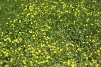
I believe these yellow five-petal flowers are called Texas Stars. (Photo by
Blaze)
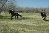
These two women were racing their horses across the Equestrian Fields that are along the west side of the George Bush Hike/Bike Trail. (Photo by
Blaze)
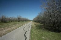
This is a view of the paved trail as it heads north to Barker-Clodine Road. (Photo by
Blaze)
This is one of the intersections of the Noble Road dirt trail and the paved George Bush Hike/Bike Trail. (Photo by
Blaze)
Some areas of the trail can be muddy, especially after it has rained. (Photo by
Blaze)
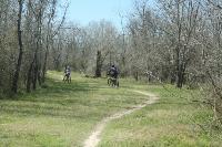
Mountain bikers like to ride the Noble Road Trail through Barker Reservoir. (Photo by
Blaze)
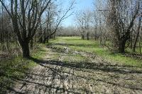
Here's an example of a primitive trail cleared out for a natural gas line running through the reservoir. You can hike it, but these primitve trails can get muddy and run into creeks and bayous that you cannot easily cross. (Photo by
Blaze)
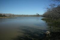
There are a few scenic ponds near the start of the Noble Road Trail. This is the smaller pond that will be on your right hand side as you enter the reservoir. (Photo by
Blaze)
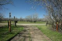
This is the start of the Noble Road Trail as seen from the top of Barker Dam as you descend into Barker Reservoir. The trail is initially paved asphalt, but soon turns to dirt. (Photo by
Blaze)