Mount Tamalpais State Park Photos
Return to Mount Tamalpais State Park
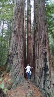
Coppertone stands right in the middle of the trail as it bisects a couple of large Redwoods. (Photo by
Austin Explorer)
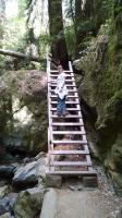
It's not too often that one finds a ladder on a trail. But here one is on the aptly named Steep Ravine Trail with Coppertone halfway up. (Photo by
Austin Explorer)
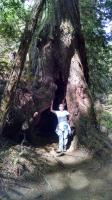
Coppertone stands in the hollowed out center of a large Redwood tree. (Photo by
Austin Explorer)
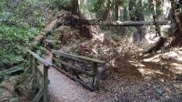
The Steep Ravine Trail features a number of bridges that cross Webb Creek. (Photo by
Austin Explorer)
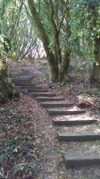
Did we mention there were lots of stairs on these trails? (Photo by
Austin Explorer)
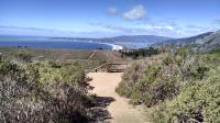
The Dipsea Trail opens up as it gets nearer to the Pacific. (Photo by
Austin Explorer)

The Dipsea Trail follows the path of the oldest trail race in America. The first Dipsea race was held in 1905. Coppertone here poses along a marker. (Photo by
Austin Explorer)
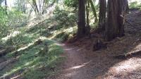
The trail as it makes a transition into a Redwood grove brings about an abrupt change in the forest floor cover. (Photo by
Austin Explorer)
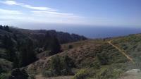
Two hikers on the trail enjoy views of the Pacific off to their right. (Photo by
Austin Explorer)
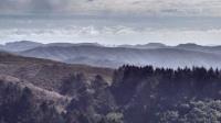
It's a bit fuzzy, but the gap in the mountains in the distance reveals the top of the Golden Gate Bridge and the skyscrapers of San Francisco. (Photo by
Austin Explorer)
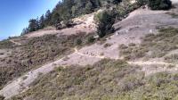
A set of hikers ahead of us along the Dipsea Trail heading towards the Pacific. (Photo by
Austin Explorer)
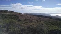
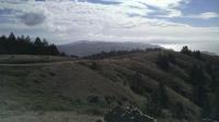
Looking towards our turnaround point, the Pacific Ocean. (Photo by
Austin Explorer)
It's a bit hard to see in the photo, but this is looking towards San Francisco from the trail. (Photo by
Austin Explorer)