San Pablo Bay National Wildlife Refuge Photos
Return to San Pablo Bay National Wildlife Refuge
We doubled back on the trail towards the trailhead on Highway 37 barely seen here in the distance. (Photo by
Austin Explorer)
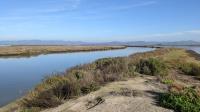
The official trail ends when it reaches the South Slough shown here. In the distance to the east lies Napa. (Photo by
Austin Explorer)
Looking east over the San Pablo Bay NWR from the trail. Hunters in kayaks can be seen in the distance and their shots could also be heard occasionally. (Photo by
Austin Explorer)
The Cullinan Ranch Trail sits on the line between the San Pablo Bay NWR on the right and the Napa-Sonoma Marshes WA on the left. (Photo by
Austin Explorer)
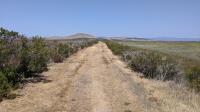
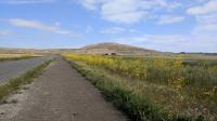
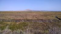
A view of the trail as we head back to the trailhead. Cougar Mountain is in the distance. (Photo by
Austin Explorer)
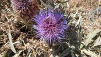
The bees and other pollinating insects were just in love this flower. Most other specimens had long ago stopped blooming. (Photo by
Austin Explorer)
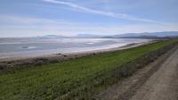
At the end of the trail along the mudflats shore of San Pablo Bay. Mount Tam is off in the distance. (Photo by
Austin Explorer)
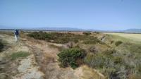
A view of the rougher Sonoma Baylands Trail. Looking west towards the Sonoma Coast and Marin County. (Photo by
Austin Explorer)
Cougar Mountain seen in the distance from the trail. Red-winged blackbirds loved the high grass on the right. (Photo by
Austin Explorer)
A view from the trail looking towards the mountains in Marin County, including Mount Tam. (Photo by
Austin Explorer)
The trail passes right by what may be the southernmost vineyard in Sonoma County, and the closest to the bay. (Photo by
Austin Explorer)
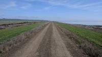
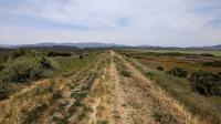
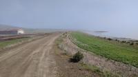
Most of the trail at Sears Point is flat and straight with grasslands to the north and newly reconstructed marshes to the south. (Photo by
Austin Explorer)
The remainder of a lingering fog comes off the water at Sears Point. (Photo by
Austin Explorer)
Coppertone hikes along the spur trail that shoots off to the east of the main trail. We startled two deer from the brush along the creek to the right. They took off across the hay field at high speed. (Photo by
Austin Explorer)
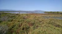
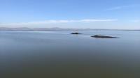
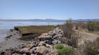
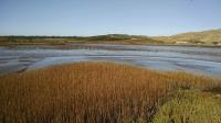
Tubbs Island lies to the left. Mud flats separate it from a separate unnamed landmass to the right. (Photo by
Austin Explorer)
Headed north back to the trailhead from Tubbs Island. (Photo by
Austin Explorer)
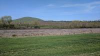
Cougar Mountain in the distance is the location of the Sonoma Raceway. Looking north from the south shore of Tubbs Island. (Photo by
Austin Explorer)
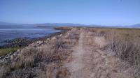
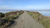
The trail along Tubbs Island looking west with San Pablo Bay on the left. (Photo by
Austin Explorer)
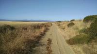
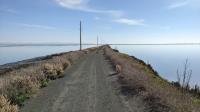
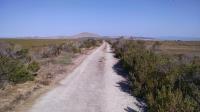
The trail is mostly utility road used by refuge staff for maintenance. The mountains of Marin lie in the distance. (Photo by
Austin Explorer)
The mud flats near the parking area were popular with foraging birds. Paradise View Vineyard lies in the distance. (Photo by
Austin Explorer)