Sonoma Valley Regional Park Photos
Return to Sonoma Valley Regional Park

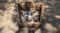
Part of the display of memorial stones for Zoe and other loved pets. Allowed only on Memorial Day weekend. (Photo by
Austin Explorer)
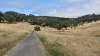
Looking down the Valley of the Moon Trail near the park's main trailhead off of Highway 12. (Photo by
Austin Explorer)
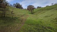
Look uphill, away from Highway 12 and try to ignore the road noise. (Photo by
Austin Explorer)
Fire ravaged parts of the park a few years back. Though scars and scorched limbs remain, things have largely recovered. (Photo by
Austin Explorer)
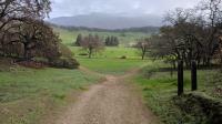
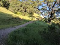
The Valley of the Moon Trail is paved and traverses from one end of the park to the other. (Photo by
Austin Explorer)

The large number of woodpeckers in the area have made their presence known. (Photo by
Austin Explorer)
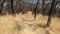
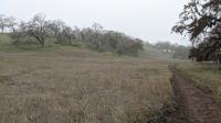
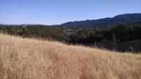
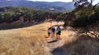
It's late enough in the year that all of the grasses have turned to a golden brown. (Photo by
Austin Explorer)
This touching memorial for victims of the 2017 fire lies along the Valley of the Moon Trail. (Photo by
Austin Explorer)
Last year's fire has left its mark as the blackened tree trunks are still apparent. (Photo by
Austin Explorer)
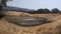
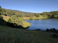
Looking over Damselfly Pond as Cougar Trail goes from left to right. (Photo by
Austin Explorer)
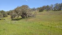
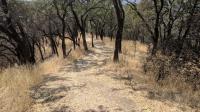
No worries about high grasses at this point in the area's fire recovery. (Photo by
Austin Explorer)
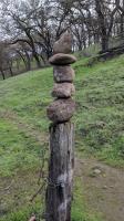
A skillfully placed cairn of rock sits atop an old fence post along the trail. (Photo by
Austin Explorer)
Lots of evidence along the trail of regrowth (green) right next to areas needing a bit more time (black). (Photo by
Austin Explorer)
Most structures of the Sonoma Developmental Center's former dairy farm burned in the fire. (Photo by
Austin Explorer)
Most of the hike was near the shore of Suttenfield Lake. Green grasses contrasted with darkened areas and trees that had not yet bounced back. (Photo by
Austin Explorer)
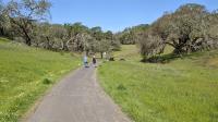
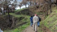
A few group members working their way down the trail. (Photo by
Austin Explorer)

This Lupine along the trail reminded me of Texas Bluebonnets. (Photo by
Austin Explorer)
A view of the lake shore and the trail that parallels it. (Photo by
Austin Explorer)
A keyhole view of the lake from the trail. Off in the distance is the Sonoma Development Center. (Photo by
Austin Explorer)
Our loop around the lake included a small detour featuring a steep ascent and descent. (Photo by
Austin Explorer)
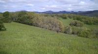
Along the rougher trails at the park there are plenty of vistas given the mix of trees, prairies, hills and mountains in the area. (Photo by
Austin Explorer)
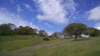
The brief dry spell even provided a few hints at blue skies. (Photo by
Austin Explorer)
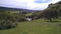
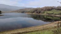
Overlooking Sutton Lake and some of the Sonoma Developmental Center land adjacent to the park. (Photo by
Austin Explorer)
Next 