Napa-Sonoma Marshes Wildlife Area Photos
Return to Napa-Sonoma Marshes Wildlife Area
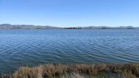
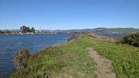
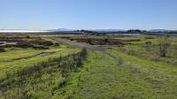
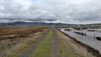
Looking over one of the largest ponds roughly towards the east. To the right of the railroad bridge tower lies American Canyon. (Photo by
Austin Explorer)
Looking northeast from the trail into Napa Valley. (Photo by
Austin Explorer)
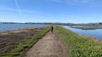
Coppertone walks along the north segment of the loop around the ponds. It's mostly open here with plenty of vistas towards mountains in all directions. (Photo by
Austin Explorer)
Looking north from the trail towards an abandoned building. (Photo by
Austin Explorer)
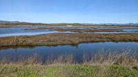
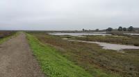
Different areas along the trail hosted differing varieties of bird habitat. Here, deeper wetlands on the left contrast with the drier and thick grassy marsh on the right. (Photo by
Austin Explorer)
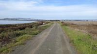
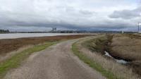
Looking back on the trail towards the trailhead on the left. (Photo by
Austin Explorer)
Coppertone walks along the trail on a berm between a marsh and a drainage channel. (Photo by
Austin Explorer)
The trail segment along the Napa River was popular with fishermen. The distinctive railroad bridge can be seen to the left. (Photo by
Austin Explorer)
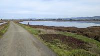
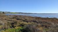
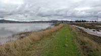
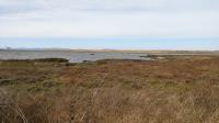
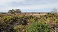
An overlook in marshland is not very high, but the flat terrain allows for distant views many miles away. Here Mount Tam can be seen just left of center. (Photo by
Austin Explorer)
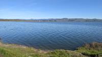
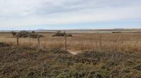
We finally spotted some large flocks of birds on the water as we started our hike. (Photo by
Austin Explorer)
Though recent rains had increased the amount of wetlands at Hudeman Slough it had not translated into many more birds. (Photo by
Austin Explorer)
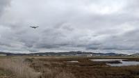
The Fagan Marsh Trail passes quite close to the Napa Airport. The real feathered birds didn't seem to mind the metal varieties that much. (Photo by
Austin Explorer)
The Fagan Marsh had some of the more heavily used waters we've seen amongst the Napa - Sonoma Marshes Wilflife Area. The skittish nature of some of the birds accounts for not seeing any here. (Photo by
Austin Explorer)
The Fagan Marsh Trail parallels the Napa River Trail, at least at first. Recent rains made the path green. (Photo by
Austin Explorer)
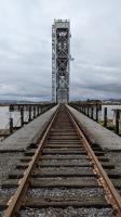
The rails leading up to the Napa River rail bridge. (Photo by
Austin Explorer)
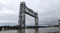
The vertical lift bridge over the Napa River was in the up position for river traffic. (Photo by
Austin Explorer)
The Napa River Trail heading north to the rail bridge that marks its end. (Photo by
Austin Explorer)
To the east, suburbia. To the west, wildlife preserve. (Photo by
Austin Explorer)
Off in the distance, flocks of birds and be found wading in the water or stalking the mudflats. (Photo by
Austin Explorer)
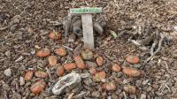
We were surprised to find a painted rock pumpkin patch next to the trail. Very appropriate for the fall just before Halloween. (Photo by
Austin Explorer)
The vistas to the west last for miles. Here the peak of Mount Tam in Marin County can be seen on the left. (Photo by
Austin Explorer)
Several picnic benches near the trailhead provide a sunny spot to enjoy a meal. (Photo by
Austin Explorer)
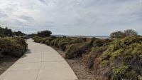
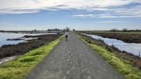
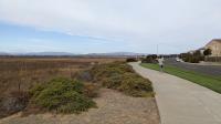
Plenty of walkers take advantage of the paved surface along the path. (Photo by
Austin Explorer)
Next 