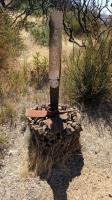
Sugarloaf Ridge State Park Photos
Return to Sugarloaf Ridge State Park
Looking back on just one set of the many stairs we had to ascend. (Photo by
Austin Explorer)
Coppertone works her way uphill on the first half of the hike. (Photo by
Austin Explorer)
It's all downhill from here, or mostly. Headed down Gray Pine Trail back towards our trailhead. (Photo by
Austin Explorer)
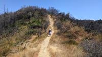
Along the upper reaches of the Brushy Peaks Trail there are several views into the adjoining Napa Valley. (Photo by
Austin Explorer)
The spur trail leading to Brushy Peaks suffered from the 2017 fire as well. But it's still serviceable. (Photo by
Austin Explorer)
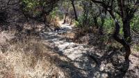
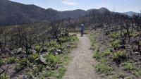
Though the park has partially healed from the 2017 fire, some damage is still evident. (Photo by
Austin Explorer)
Looking down the canyon back towards the trailhead in the distance. (Photo by
Austin Explorer)
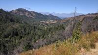
A look at the vineyard on the opposite side of the canyon. (Photo by
Austin Explorer)
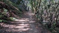
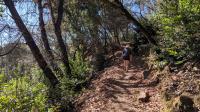
The trail followed a dry creek at the start with plenty of tree cover. (Photo by
Austin Explorer)
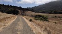
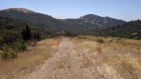
The Meadow Trail rolls over gentle hills and is typically open to the Sun. (Photo by
Austin Explorer)
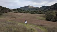
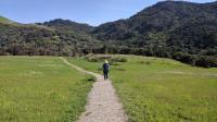
The unnamed trail off of Pony Gate leads more directly back to the park entrance and provided some of the first open sky views of our hike. Here, Coppertone descends down a meadow with the peaks of Sugarloaf Ridge in the distance. (Photo by
Austin Explorer)
Pony Gate consisted of near constant ascents, crossing several streams. (Photo by
Austin Explorer)
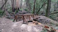
Volunteers have done a wonderful job of maintaining the trails, here repairing a bridge to make the journey easier. (Photo by
Austin Explorer)
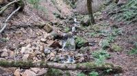
The main feature of this hikes is the waterfall that merely goes by the name "Seasonal Waterfall" on official maps. Note the visitor above the falls for a sense of scale. (Photo by
Austin Explorer)
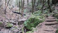
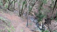
Most of the Canyon Trail is heavily forested with steep descents or ascents. (Photo by
Austin Explorer)
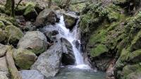
Even some of the smaller water falls on the hike were a nice feature to find along the trail. (Photo by
Austin Explorer)
As we got nearer to our trailhead even Lower Bald Mountain Trail got greener and left us with high hopes for a full recovery of the park from the fire. (Photo by
Austin Explorer)
Lower Bald Mountain Trail was heavily hit by the fire, particularly near the junction with Bald Mountain Trail. (Photo by
Austin Explorer)
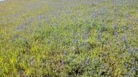
The blue lupine remind us of Texas Bluebonnets, which also bloom at this time of year. (Photo by
Austin Explorer)
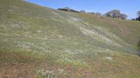
The wildflowers were out in force and might have been even more impressive in a week or so. (Photo by
Austin Explorer)
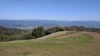
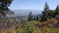
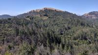
Napa Valley as seen from the top of Bald Mountain. (Photo by
Austin Explorer)
 BackNext