Sugarloaf Ridge State Park Photos
Return to Sugarloaf Ridge State Park
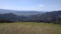
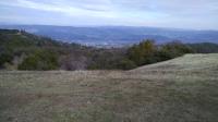
Sonoma Valley as seen from the top of Bald Mountain. (Photo by
Austin Explorer)
Looking back down Gray Pine Trail, from a distance it's sometimes hard to tell which areas burned and which didn't. (Photo by
Austin Explorer)
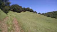
Near the peak of Bald Mountain things look more verdant with plenty of fresh grasses and wildflowers coating the slopes. (Photo by
Austin Explorer)
On the upper reaches of Gray Pine Trail one can see signs of burned vegetation and plenty of knocked over trees that were part of a fire line carved into the terrain. (Photo by
Austin Explorer)
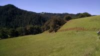
A view along the trail showing the crazy patchwork of vegetation with a mixture of burned, unburned and rejuvenated sections. (Photo by
Austin Explorer)
The hike offered an opportunity to view the damage to the park such as this burned area. (Photo by
Austin Explorer)
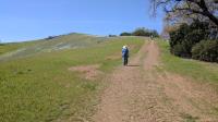
Part of the group make their way up a steep section of trail. (Photo by
Austin Explorer)
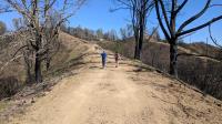
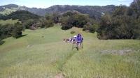
The group got strung out again the trail on the way back. (Photo by
Austin Explorer)
The group passes by an imposing dead Big Leaf Maple tree. (Photo by
Austin Explorer)
The group nears Red Hill, our picturesque lunch spot. (Photo by
Austin Explorer)
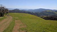
Despite following a ridge, the trail involved some steep sections. (Photo by
Austin Explorer)
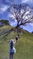
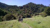
Hiking along the ridge towards the Grandmother Tree. (Photo by
Austin Explorer)
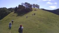
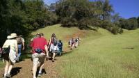
Over time and when coming up to steeper sections, the group tended to spread out along the trail. (Photo by
Austin Explorer)
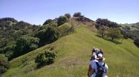
The group working its way toward the Grandmother Tree. (Photo by
Austin Explorer)
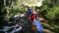
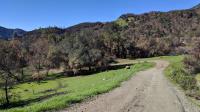
The group was able to cross Santa Rosa Creek without too much difficulty. (Photo by
Austin Explorer)
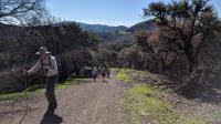
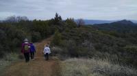
The front of our hiking group heading through Hood Mountain Regional Park on the way to Sugarloaf Ridge. (Photo by
Austin Explorer)
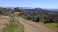
Descending back to the trailhead via Gray Pine Trail. (Photo by
Austin Explorer)
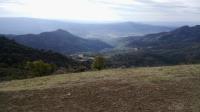
Looking down into Napa Valley from the top of Bald Mountain. (Photo by
Austin Explorer)
From the top of Bald Mountain one can easily see two of California's most celebrated wine regions. Here's Sonoma Valley. (Photo by
Austin Explorer)
 BackNext