Sugarloaf Ridge State Park Photos
Return to Sugarloaf Ridge State Park
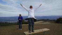
Coppertone at the top of Bald Mountain. The wind at the top soon drove us to put our gloves back on. (Photo by
Austin Explorer)
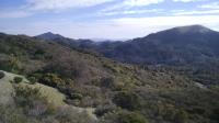
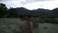
From the Indian Rock spot one can look up and down the valley that form the headwaters of Sonoma Creek. (Photo by
Austin Explorer)
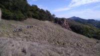
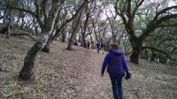
The guided group following the trail that snakes along the hillside towards our turnaround point, a wonderful promontory I thought was called Indian Rock. (Photo by
Austin Explorer)
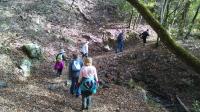
Our guided group fords a small stream crossing on the way to our intended scenic view. (Photo by
Austin Explorer)
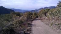
Looking back down Bald Mountain Trail. Most of this trail to the summit is paved. (Photo by
Austin Explorer)
There's not too much tree cover on the way up Bald Mountain, but we did get some. (Photo by
Austin Explorer)
Heading up hill on Lower Bald Mountain Trail, not too far from the park observatory. (Photo by
Austin Explorer)
 Back
Back